GEOxyz
Independent survey contractor specialising in hydrographic, geophysical and geotechnical surveys, site investigations and offshore renewable-energy support.
GEOxyz is a maritime data and survey company focused on marine site investigations, subsea and marine asset integrity, land survey, and UXO risk management. The company says it provides innovative solutions for hydrographic, geophysical, geotechnical, environmental, metocean, and topographic work, and it supports both offshore and onshore projects with positioning, monitoring, and reporting services. Its role is to supply clients with the information and data needed to design, construct, and maintain structures and infrastructure.
The company serves industries involved in offshore, nearshore, and onshore activities, including marine construction, dredging, offshore support, and offshore renewable energy. Its text also indicates work for authorities, consulting companies, and research centers. GEOxyz states that it operates across Europe and undertakes specific projects around the world, showing a broad geographic scope rather than a single local market.
A distinctive part of the business is its combination of survey capability, asset integrity support, and operational marine services. In addition to investigation and survey work, GEOxyz offers subsea tools and services such as remotely operated vehicle work, cable tracking, cable and pipe touchdown monitoring, scour monitoring and protection, salvage support, and crew transfers. It also provides land-based capabilities including topography, offshore and onshore positioning, monopile positioning, UAV and USV operations, and dredge registration systems. The company emphasizes the use of its own expertise, people, equipment, and technology, and it mentions in-house research and development as part of its approach.
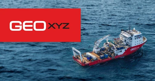
GEOxyz also highlights fleet and platform capabilities that support its projects, including large offshore vessels, crew transfer vessels, unmanned surface vehicles, and maritime drones. It describes developing its own USVs that can carry multiple sensors and references metocean monitoring through the ACCURASEA buoy, which is used to measure wind accurately in offshore wind farm conditions. Overall, the business appears to combine data acquisition, monitoring, and marine support across the full lifecycle of offshore and onshore projects.